Standing above Cappadocia’s valleys at sunrise, it is difficult to imagine that this extraordinary landscape was once part of an extensive volcanic plateau.
Today, thousands of fairy chimneys rise from the valleys, their colours changing from pale cream to pink and deep red as the sunlight moves across the rocks. Cave dwellings and ancient churches occupy the cliffs, while distant volcanic mountains stand along the horizon.
But how did Cappadocia become this remarkable landscape? To understand how Cappadocia was formed, we need to travel millions of years into the past, when powerful volcanic eruptions transformed Central Anatolia.
The familiar explanation is simple: Mount Erciyes and Mount Hasan erupted, volcanic ash covered the region, and wind and rain gradually created the fairy chimneys.
The real geological history is considerably more complicated.
Many of the volcanic deposits around Göreme originated from ancient volcanic systems active millions of years before the relatively young eruptions of Mount Erciyes. Powerful pyroclastic flows spread enormous quantities of material across Central Anatolia. Over time, tectonic uplift, flowing water and weathering transformed the resulting plateau into valleys, cliffs and isolated rock formations.
The volcanic history did not end there. Later eruptions created new volcanic landscapes, including craters and lava domes, while prehistoric communities began using obsidian from Cappadocia’s volcanoes to manufacture tools.
Eventually, people carved homes, churches and underground cities into the volcanic rocks.
As a professional tour guide based in Cappadocia, I believe the region becomes even more fascinating when we understand the history behind its scenery.
This is the story of how fire, water, geological time and human ingenuity shaped Cappadocia.
For information about visiting the region, explore our complete Cappadocia travel guide.
1. Cappadocia Before the Volcanoes
The geological history of Cappadocia begins long before its famous fairy chimneys.
The region lies within the Central Anatolian Plateau, where the Earth’s crust has undergone a complex history of tectonic deformation, sedimentation and volcanism.
Over geological time, interactions between the African, Arabian and Eurasian tectonic plates contributed to the deformation of Anatolia.
These movements did not create Cappadocia in a single event. Instead, they influenced the development of mountain ranges, fault systems, basins and volcanic provinces over millions of years.
The rocks beneath Cappadocia’s volcanic landscape include formations considerably older than the visible fairy chimneys.
During parts of the Cenozoic Era, basins developed across Central Anatolia. Rivers and lakes deposited sediments, while volcanic activity gradually became increasingly important in the region’s geological evolution.
Magma rose through fractures and zones of weakness in the Earth’s crust.
Some eruptions produced lava flows and volcanic cones.
Others were far more explosive.
These explosive events would eventually provide much of the volcanic material from which Cappadocia’s famous rock formations developed.
2. The Great Volcanic Eruptions of the Miocene
One of the most important stages in Cappadocia’s geological history began approximately 10–11 million years ago, during the Late Miocene.
At that time, Central Anatolia was affected by extensive volcanic activity.
According to geologists Attila Çiner and Erkan Aydar, powerful eruptions spread ignimbrites and other pyroclastic deposits across an area of approximately 20,000 square kilometres.
These deposits accumulated during multiple eruptive episodes over several million years.
Some were produced by enormous explosive eruptions capable of spreading volcanic material over considerable distances.
Understanding these deposits is essential to understanding the modern landscape.
What is an ignimbrite?
An ignimbrite is a volcanic deposit formed mainly from pyroclastic density currents.
During an explosive eruption, hot mixtures of gas, volcanic ash, pumice and rock fragments can move rapidly across the ground.
These currents may travel down valleys and spread across large areas.
When the volcanic material settles, it can form thick deposits.
Depending on the temperature and conditions of deposition, the particles may become strongly welded together or remain relatively weakly consolidated.
This distinction matters.
Strongly welded ignimbrites are generally more resistant to erosion than poorly welded deposits, although their behaviour also depends on composition, fracturing and weathering.
Cappadocia contains volcanic rocks with differing levels of resistance.
Those differences eventually helped determine which portions of the landscape would survive as plateaus, cliffs and fairy chimneys.
Is all Cappadocian rock volcanic tuff?
Visitors often hear that Cappadocia is made of tuff.
That is a useful general explanation, but the geological reality is more diverse.
Tuff is a rock formed primarily from consolidated volcanic ash.
Ignimbrites, other pyroclastic rocks and reworked volcanic sediments may all occur within Cappadocia’s geological succession.
Lava flows are also present in the wider volcanic province.
The region therefore contains rocks produced by different processes, under different conditions, and at different times.
These variations explain much of its remarkable geological diversity.
3. Did Mount Erciyes Create Cappadocia’s Fairy Chimneys?
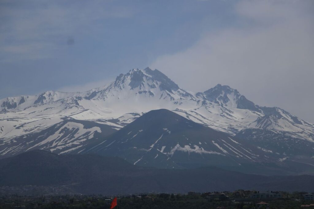
This question deserves particular attention because it is one of the most common misconceptions about Cappadocia’s geology.
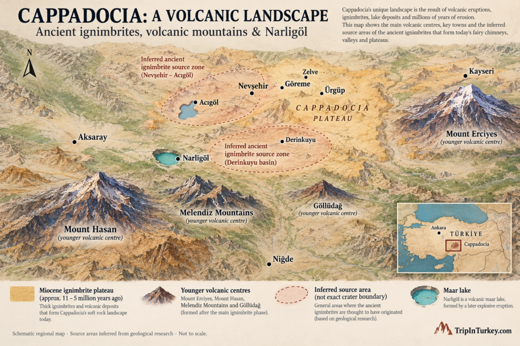
Mount Erciyes is often presented as the primary source of the volcanic ash that formed the fairy chimneys around Göreme.
However, many of the principal ignimbrite deposits in the Göreme area are substantially older than the major activity associated with the present Erciyes volcanic edifice.
Research has identified a much more complex history involving ancient volcanic centres across the Nevşehir Plateau and southern Cappadocia.
Ancient volcanic sources around Nevşehir and Derinkuyu
In 1994, Jean-Louis Le Pennec and colleagues published an important study examining the Neogene ignimbrites of the Nevşehir Plateau.
They investigated the distribution, stratigraphy and possible sources of major volcanic deposits.
Their research identified the older Kavak ignimbrites, followed by several major units, including Zelve, Sarımaden Tepe, Cemilköy, Gördeles and Kızılkaya.
The researchers also recognised smaller or more restricted units, including Tahar and Sofular.
Their geological interpretations indicated that important eruption sources may have existed around the Nevşehir–Derinkuyu area and farther south.
Some of these ancient systems may have involved large volcanic depressions or calderas.
A caldera forms when a volcanic structure collapses, often following the evacuation of substantial amounts of magma during a major eruption.
Over millions of years, such structures can become buried, filled with younger deposits, faulted or eroded.
Consequently, the ancient eruption sources responsible for Cappadocia’s volcanic plateau may no longer resemble the prominent volcanic mountains visible today.
Why identifying the source matters
Volcanologists do not identify an eruption’s source simply by looking for the nearest mountain.
They compare the chemical composition of volcanic rocks, analyse minerals and pumice fragments, study the distribution and thickness of deposits, and establish their ages using radiometric dating techniques.
Geologists can then correlate deposits across considerable distances.
This is why the statement that all Cappadocia’s fairy chimneys came from Erciyes is not supported by the region’s detailed geological history.
A more accurate explanation is that Cappadocia’s famous landscapes developed from deposits produced by several ancient volcanic systems, subsequently transformed by erosion.
Mount Erciyes belongs to that wider volcanic history, but its role must be considered in the context of the age and origin of each volcanic unit.
4. A Timeline of Cappadocia’s Volcanic History
Cappadocia’s volcanic landscape did not develop during a single period of eruptions.
Different volcanic deposits record different geological events.
The principal ignimbrite succession of the Nevşehir Plateau developed mainly during the Late Miocene, while younger volcanic activity continued in parts of Central Anatolia into the Pleistocene and Holocene.
A simplified geological timeline helps explain the sequence.
| Period | Geological development |
|---|---|
| Before approximately 11 million years ago | Older tectonic, sedimentary and volcanic processes shaped the geological foundations of Central Anatolia. |
| Approximately 10–11 million years ago | Major Late Miocene ignimbrite-forming volcanism developed across the Nevşehir Plateau. |
| Approximately 9–7 million years ago | Additional explosive eruptions produced several important volcanic deposits, including the Zelve, Sarımaden Tepe and Cemilköy units. |
| Approximately 7–5 million years ago | Later eruptions contributed further ignimbrite deposits; the Kızılkaya ignimbrite has been dated to approximately 5.5 million years ago. |
| Approximately 2.73 million years ago | A major event in the Erciyes volcanic complex produced the Valibaba Tepe ignimbrite and was associated with Koç Dağ caldera collapse. |
| Pleistocene | Continued volcanic activity, tectonic modification and erosion influenced the regional landscape. |
| Approximately 29,000 years ago | Geological evidence indicates an explosive eruption at Hasan Dağı. |
| Approximately 11,300–9,000 years ago | Holocene eruptions occurred in the Erciyes volcanic system. |
| Approximately 9,000 years ago | Another explosive episode is documented at Hasan Dağı, broadly overlapping the Neolithic period. |
| Late Pleistocene | The Narköy maar, now occupied by Narlıgöl, formed during a phreatomagmatic eruption; its precise age is not established. |
These dates refer to different events in different volcanic systems.
Some geological ages remain subject to revision as dating methods and stratigraphic interpretations improve.
Importantly, the formation of the volcanic deposits and the later sculpting of fairy chimneys should not be treated as the same event.
The rocks are millions of years old, but the visible landforms evolved over a much longer and more complex period of erosion.
5. The Volcanoes of Cappadocia and Central Anatolia
Mount Erciyes: A giant with a younger volcanic history
Rising to approximately 3,917 metres above sea level, Mount Erciyes dominates the skyline around Kayseri.
It is a stratovolcano constructed through successive periods of lava extrusion and explosive volcanic activity.
Its geological history involves older Koç Dağ volcanism, caldera collapse and later development of the volcanic edifice.
One of the major events occurred approximately 2.73 million years ago, when a large eruption produced the Valibaba Tepe ignimbrite.
This eruption was associated with the collapse of the Koç Dağ caldera.
The event was significant for the local volcanic landscape, but it occurred millions of years after some of the most important ignimbrite eruptions responsible for the older Göreme rock formations.
This chronological difference explains why attributing the formation of Göreme’s fairy chimneys entirely to Erciyes is misleading.
Erciyes erupted during the Holocene
Modern research has also revealed surprisingly recent volcanic activity around Erciyes.
A study published in April 2026 reconstructed several explosive eruptions using volcanic deposits, geochemical evidence and radiocarbon dating.
The researchers identified three important eruptive events:
- Karagüllü: approximately 11,258 calibrated years before present.
- Perikartın: approximately 9,700 calibrated years before present.
- Dikkartın: approximately 9,000 calibrated years before present, based on correlation with another volcanic ash record.
In geological dating, calibrated years before present are conventionally measured relative to AD 1950.
The research also identified ash from the Karagüllü eruption in distant sedimentary archives, including the Black Sea region.
This suggests that volcanic ash from Erciyes travelled hundreds of kilometres, and in some cases more than a thousand kilometres.
Such evidence demonstrates that Central Anatolia’s volcanic history continued long after the main Miocene ignimbrite-forming episodes.
Mount Hasan: A volcano connected to prehistoric history
Mount Hasan, near Aksaray, is another major volcanic complex.
Its two prominent summits make it one of the most recognisable mountains in Central Anatolia.
The volcanic history of Hasan Dağı is not limited to its relatively recent eruptions.
Geological studies indicate that its older volcanic activity extends back into the Miocene, with some early lavas dated to approximately 7.2 million years ago and evidence of ignimbrite-forming activity around 6.3 million years ago.
Later volcanic phases developed during the Pleistocene and Holocene.
This long evolution makes Hasan Dağı important for understanding Central Anatolia’s regional volcanism.
However, it should not be assumed that all volcanic deposits around Göreme originated from Hasan Dağı.
Each geological unit requires its own source interpretation.
Did Neolithic people witness an eruption of Hasan Dağı?
This is one of the most fascinating connections between geology and archaeology in Anatolia.
In 2014, researchers led by Axel Schmitt published evidence of explosive eruptions at Hasan Dağı.
They dated pumice associated with one eruption to approximately 8,970 ± 640 years before present, equivalent to roughly 6960 ± 640 BCE.
That date overlaps with the Neolithic occupation of Çatalhöyük.
Why is this significant?
Because archaeologists have long debated whether a famous wall painting from Çatalhöyük depicts Hasan Dağı erupting.
6. Çatalhöyük and the Mystery of the Volcano Painting
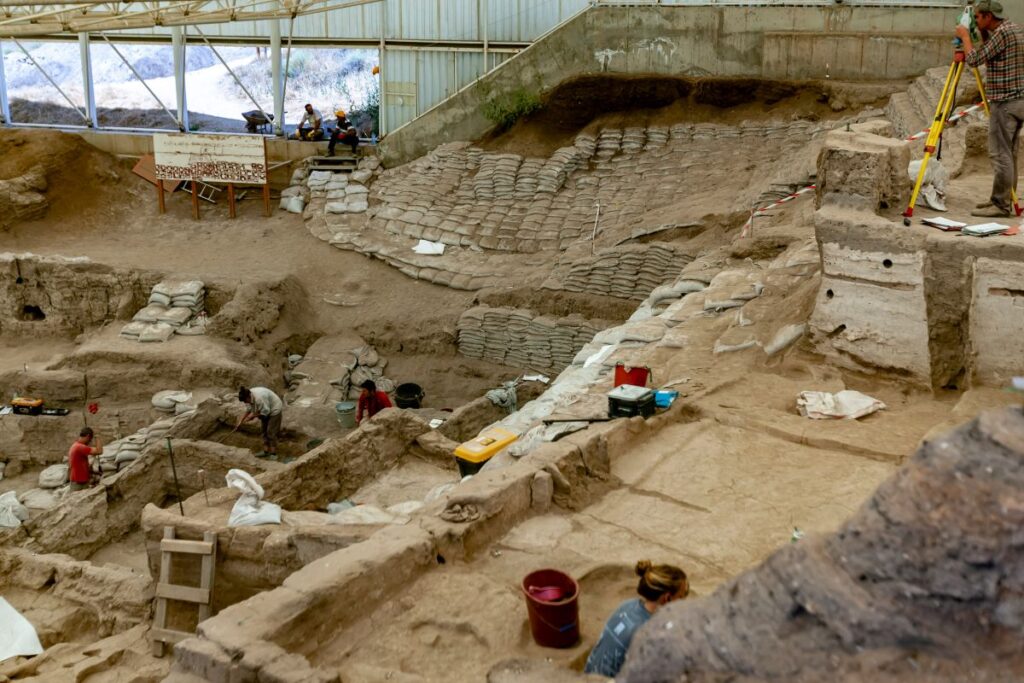
Çatalhöyük, located on the Konya Plain, is among the most important Neolithic archaeological sites in the world.
Its densely arranged mudbrick houses, elaborate wall paintings, burials and everyday objects provide extraordinary evidence of prehistoric life.
The settlement flourished thousands of years before the development of the ancient kingdoms associated with Cappadocia.
Although Çatalhöyük lies outside the principal tourist landscape of Göreme, its inhabitants were connected to the volcanic regions of Central Anatolia.
One archaeological discovery is especially relevant.
A painting that may show a volcanic eruption
During excavations in the 1960s, archaeologist James Mellaart uncovered a remarkable wall painting dating to approximately 6600 BCE.
The painting contains two main visual elements.
The lower section consists of closely arranged rectangular or geometric shapes.
The upper section includes a large, irregular form with two prominent peaks.
Mellaart proposed that the lower section represented a settlement viewed from above and the upper section depicted an erupting volcano.
The two peaks were interpreted as Mount Hasan.
If this interpretation is correct, the painting could be among the earliest known representations of a landscape or a volcanic eruption.
It would also suggest that prehistoric communities recorded a dramatic natural event through visual imagery.
Could the painting represent something else?
Not all archaeologists agree with the volcanic interpretation.
An alternative explanation identifies the upper form as a leopard skin and the lower geometric arrangement as a decorative pattern.
Leopard imagery was an important element of Çatalhöyük’s symbolic world.
The presence of similar animal motifs elsewhere at the site makes this interpretation plausible.
Consequently, the painting remains a subject of scholarly debate.
What did the 2014 geological research discover?
The research team led by Axel Schmitt analysed volcanic material collected from Hasan Dağı.
Using uranium–thorium and helium dating methods applied to zircon minerals, the researchers established that an explosive eruption occurred during the Holocene.
The estimated eruption date overlaps with the archaeological period associated with the painting.
This provided geological evidence that people living in the wider region could have witnessed volcanic activity.
However, the dating uncertainty does not establish that the painting and eruption occurred at precisely the same time.
Neither can geological analysis alone determine what an artist intended to depict.
The scientific evidence therefore strengthens the volcanic interpretation without conclusively proving it.
Why this matters for Cappadocia
The Çatalhöyük painting creates a possible connection between prehistoric art, geological events and the cultural memory of ancient communities.
It also reminds us that the volcanoes of Central Anatolia were not merely features of a distant geological past.
Some were active while human communities were already living, farming and creating art in the region.
And volcanic materials linked Çatalhöyük to Cappadocia in another way that can be demonstrated much more directly: obsidian.
For more information about the settlement and other prehistoric communities, explore our guide to the Neolithic sites of Turkey.
7. Göllüdağ, Nenezi Dağı and the Prehistoric Obsidian Networks
Volcanic activity created more than scenic mountains and unusual rock formations.
It also produced materials that played an important role in prehistoric technology.
One of the most valuable was obsidian.
What is obsidian?
Obsidian is a natural volcanic glass produced when suitable silica-rich lava cools rapidly, preventing the development of a substantial crystalline structure.
When fractured, obsidian can form extremely sharp edges.
Before metal tools became widespread, this property made it an important raw material for cutting implements, blades and projectile points.
The volcanic areas of Göllüdağ, Nenezi Dağı and Acıgöl provided significant obsidian sources.
How do we know that Çatalhöyük used Cappadocian obsidian?
Archaeologists have investigated the chemical composition of obsidian artefacts found at Çatalhöyük.
A 2006 study by Tristan Carter and colleagues analysed 135 obsidian artefacts, identifying material associated with three Cappadocian sources: eastern Göllüdağ, Nenezi Dağı and western Acıgöl.
In another study published in 2007, Carter and Michael Shackley examined 42 obsidian artefacts from a Neolithic building.
Their analyses linked the samples to eastern Göllüdağ and Nenezi Dağı.
These findings are important because different obsidian sources have distinctive geochemical signatures.
By comparing archaeological artefacts with geological source samples, researchers can reconstruct the movement of raw materials across prehistoric landscapes.
The evidence shows that obsidian travelled from the volcanic regions of southern Cappadocia to the Konya Plain.
This does not necessarily mean that every piece was obtained through organised trade in the modern sense. Materials may have moved through several forms of procurement, exchange and social interaction.
Nevertheless, the archaeological evidence demonstrates a meaningful relationship between Cappadocia’s geology and the technology of Neolithic communities.
Aşıklı Höyük: An early settlement close to volcanic resources
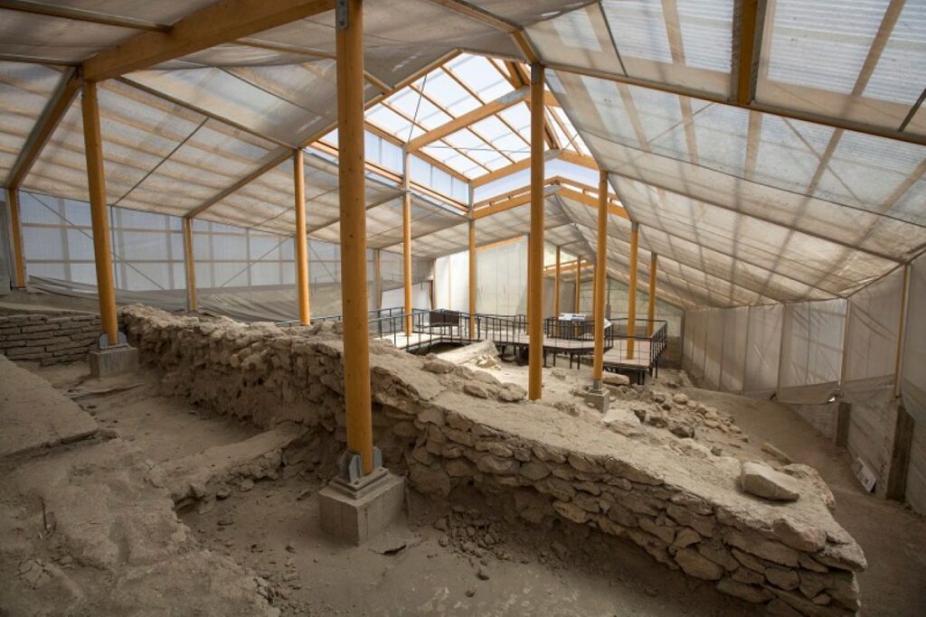
The relationship between prehistoric people and Cappadocia’s geology is also visible at Aşıklı Höyük.
Located near the Melendiz River in present-day Aksaray Province, Aşıklı Höyük was occupied during the ninth and eighth millennia BCE.
Its inhabitants developed permanent houses, managed resources and participated in the gradual transformation of Neolithic lifeways.
The settlement existed in a landscape shaped by volcanic activity and close to important obsidian-bearing regions.
Together, Aşıklı Höyük and Çatalhöyük demonstrate that the volcanic history of Central Anatolia influenced human societies long before the emergence of Cappadocia’s famous underground cities and churches.
8. How Did Cappadocia’s Fairy Chimneys Actually Form?
The volcanic eruptions provided the raw material.
The fairy chimneys were created later, mainly through weathering and erosion.
This distinction is one of the most important facts about Cappadocia.
The present shapes of the fairy chimneys were not produced directly by volcanic explosions.
Instead, they developed as volcanic plateaus were gradually dissected and eroded.
Stage one: Volcanic deposits accumulated
Repeated eruptions spread layers of ash-rich material, pumice and pyroclastic deposits across the region.
Some layers became strongly consolidated or welded.
Others remained comparatively soft and more easily weathered.
The resulting landscape contained extensive surfaces of volcanic rock.
Stage two: Tectonic uplift changed the landscape
Regional tectonic movements contributed to the uplift and deformation of the Central Anatolian Plateau.
The volcanic rocks developed or inherited fractures and joints.
These weaknesses influenced the direction of subsequent erosion.
Water could penetrate cracks, and streams began cutting more deeply into the exposed deposits.
Stage three: Water carved valleys and gullies
Rainfall, surface runoff and stream erosion progressively removed volcanic material.
The original plateau was divided into ridges, cliffs and narrow valleys.
Some sections resisted erosion more effectively than others.
As the surrounding material was removed, isolated rock towers began to emerge.
Although wind can influence weathering and sediment transport, it is inaccurate to explain Cappadocia’s landforms mainly through wind erosion.
Flowing water and differences in rock resistance are central to the development of the region’s fairy chimneys.
Stage four: Differential erosion produced distinctive shapes
Differential erosion occurs when neighbouring rocks or rock layers erode at different rates.
Where relatively resistant material protects softer rock below it, the protected section may remain standing while surrounding material disappears.
This can produce a fairy chimney with a broad cap and a narrower column beneath it.
However, fairy chimney caps are not always basalt.
Depending on the location, they may consist of more resistant ignimbrite or other volcanic rock.
In parts of the Damsa Valley, for example, blocks of resistant Kızılkaya ignimbrite can protect underlying Cemilköy ignimbrite.
Other formations develop without prominent caps.
Fractures, slopes, water movement and variations within the volcanic deposits produce cones, pinnacles, ridges and columns of different shapes.
Stage five: Erosion continues today
Cappadocia’s fairy chimneys are not permanent or unchanging monuments.
Rainfall, freeze–thaw processes, chemical weathering and gravity continue to affect their surfaces.
Sections of rock may weaken, detach or collapse.
A 2015 study by Mehmet Akif Sarıkaya, Attila Çiner and Marek Zreda measured erosion rates in different stages of fairy chimney development.
Their findings showed that erosion rates differ markedly between relatively stable plateau surfaces, the resistant caps of fairy chimneys and more exposed surfaces after a chimney disappears.
The landscape therefore continues to evolve.
A fairy chimney represents a temporary stage in a long geological process.
9. Why Do Cappadocia’s Fairy Chimneys Look So Different?

One of the most revealing ways to understand Cappadocia’s geology is to compare its rock formations.
Although they share a broadly similar volcanic environment, their appearance varies according to local rock properties, fractures and erosional history.
Paşabağ: Mushroom-shaped formations
Paşabağ, also called Monks Valley, contains some of Cappadocia’s most famous capped fairy chimneys.
Their wide, relatively resistant upper sections protect narrower columns beneath.
Some formations have multiple caps, producing clusters that resemble giant stone mushrooms.
Paşabağ is an excellent example of differential erosion.
Love Valley: Tall rock pillars
Love Valley contains unusually tall, slender rock formations.
Many do not have the broad caps associated with Paşabağ.
Their shapes reflect different patterns of erosion, rock resistance and fracture development.
The valley demonstrates that fairy chimneys can develop in several forms rather than through one identical process.
Devrent Valley: Naturally sculpted shapes
Devrent Valley is known for unusual rock formations that resemble animals and other familiar figures.
These forms are the result of natural weathering and erosion.
Their resemblance to animals is a product of human interpretation rather than deliberate carving.
Devrent shows how subtle differences in rock structure and resistance can produce striking natural sculptures.
Zelve: Rock formations adapted for human life
Zelve combines complex erosional forms with historic rock-cut architecture.
Its cliffs, cones and narrow passages demonstrate how ancient communities made use of naturally exposed volcanic rock.
Here, the connection between geological processes and human settlement is especially visible.
Explore these and other remarkable places in our best things to do in Cappadocia guide.
10. How Were Cappadocia’s Valleys Formed?
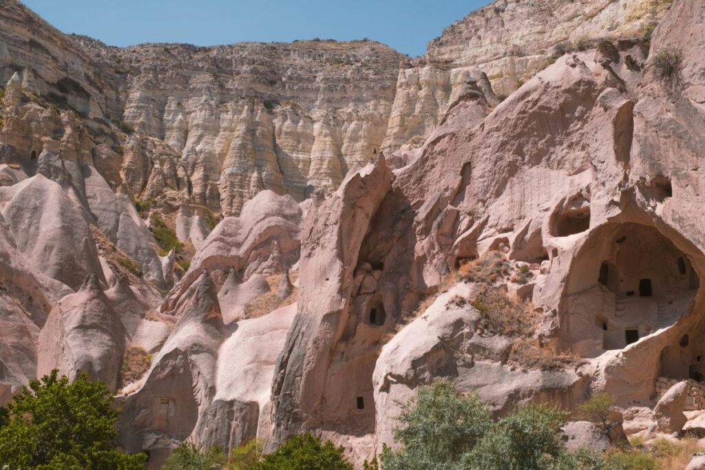
Cappadocia’s valleys developed as streams and runoff progressively cut into volcanic deposits.
The shape of each valley reflects variations in bedrock, drainage patterns, fractures, slope stability and weathering.
Rose Valley and Red Valley
Rose Valley and Red Valley are famous for their pink, orange and reddish rock formations.
Their colours reflect differences in volcanic materials, weathering processes and the chemical alteration of minerals.
Oxidation of iron-bearing components contributes to many of the reddish and brown tones.
The exact appearance of a rock surface also depends on sunlight.
At sunrise and sunset, the low angle of the sun enhances the contrast between different layers and exposed slopes.
This is why the valleys can appear dramatically different throughout the day.
Their beauty, however, is grounded in a complex geological history.
Pigeon Valley
Pigeon Valley developed through the erosion of volcanic deposits between the Göreme and Uçhisar area.
Later communities carved pigeon houses into suitable rock surfaces.
Pigeon manure was valuable in local agriculture, particularly for vineyards and gardens.
The valley offers another example of people adapting to geological conditions rather than creating the landscape itself.
Ihlara Valley: The power of the Melendiz River
Ihlara Valley is different from the more open fairy chimney landscapes near Göreme.
Its dramatic canyon developed as the Melendiz River and its drainage system incised volcanic terrain.
Running water gradually deepened the valley and exposed steep cliffs.
The canyon later became an important setting for rock-cut churches and settlements.
Today, Ihlara preserves evidence of both geological erosion and centuries of human activity.
Soğanlı Valley
Soğanlı Valley offers another distinctive combination of eroded volcanic scenery and historic rock-cut architecture.
Compared with the busiest parts of Göreme, its landscape is less dominated by tourist development.
Its formations and churches demonstrate how the geological character of Cappadocia extends well beyond the most famous valleys.
For travellers wishing to explore these environments on foot, our guide to Turkey’s best hiking trails provides further inspiration.
11. Narlıgöl: A Volcanic Lake Formed by an Explosion
Most visitors associate Cappadocia’s geology with fairy chimneys.
Yet one of the region’s most interesting volcanic features is a lake.
Narlıgöl, located near the Aksaray–Niğde provincial boundary, occupies a volcanic crater known in geological literature as the Narköy maar.
Its heart-like appearance has made it a popular photography destination.
But the lake’s formation represents a very different process from the erosion that created Göreme’s fairy chimneys.
What is a maar?
A maar is a volcanic crater commonly formed when magma interacts explosively with groundwater.
As magma rises toward the surface, it may encounter water within the surrounding rocks.
Under suitable conditions, the interaction causes rapid vaporisation, fragmentation and explosive release of material.
Repeated explosions can excavate a relatively broad crater.
When eruptive activity ceases, groundwater and precipitation may accumulate within the depression, creating a lake.
The formation of Narlıgöl
In 2000, geologists Ali İhsan Gevrek and Nizamettin Kazancı published a study of the Narköy maar.
They identified it as a Late Pleistocene feature developed along a geological fault zone.
Their research described an approximately 900-metre-wide crater and a relatively limited volume of pyroclastic deposits.
The eruption involved two episodes within one eruptive period.
The first produced wetter eruption clouds, while the second was relatively drier.
This combination of magma, groundwater and fault-controlled hydrothermal activity distinguishes Narlıgöl from the older volcanic plateau landscapes.
Is Narlıgöl still geothermally active?
The surrounding area contains hot springs and other signs of geothermal activity.
These indicate that underground water circulates through a geologically active thermal environment.
However, the presence of geothermal water does not automatically indicate that magma is rising toward the surface or that another volcanic eruption is imminent.
The lake’s 14,000-year climate record
Narlıgöl also preserves a remarkable archive of environmental history.
Scientists have studied sediment cores from its lake floor to reconstruct changing climate and environmental conditions over approximately the last 14,000 years.
These sediments contain evidence of changes in lake water, mineral deposition and vegetation.
Researchers have identified transitions between relatively wetter and drier climatic phases.
The record includes environmental changes associated with the transition from the last glacial period into the Holocene.
It also provides evidence of later climate variability in Central Anatolia.
The geological importance of these findings is considerable.
Narlıgöl allows scientists to study changes in the regional environment long after its original volcanic crater had formed.
However, the oldest dated lake sediments should not be mistaken for the exact age of the maar-forming eruption.
The crater may be older than the surviving sediment record.
12. From Volcanic Rock to Underground Cities
Cappadocia’s volcanic history ultimately influenced the way people lived.
Many of the region’s volcanic rocks could be excavated using suitable tools while remaining sufficiently coherent to support chambers, passages and carved structures under appropriate conditions.
This combination encouraged the development of rock-cut architecture.
Derinkuyu and Kaymaklı
The underground cities of Derinkuyu and Kaymaklı demonstrate how generations of inhabitants adapted the geological environment to their needs.
Underground spaces were excavated and enlarged over different historical periods.
The complexes include corridors, ventilation shafts, storage areas, water facilities and defensive features.
Their development should not be attributed entirely to a single civilisation or historical event.
Instead, they represent a long history of human modification and reuse.
The underlying geology made extensive excavation possible, while the needs of successive communities influenced the architecture.
Discover their history in our guide to the underground cities of Cappadocia.
Göreme’s rock-cut churches
The same volcanic environment supported the development of religious architecture.
During the Roman and Byzantine periods, Christian communities established churches, monasteries and other religious spaces in the region.
Many structures were excavated directly into the rock.
Some were decorated with remarkable paintings, including the surviving frescoes of the Göreme Open-Air Museum.
The volcanic rock provided the architectural possibilities, but the religious and cultural traditions of the inhabitants determined how these spaces were used.
From geology to cultural heritage
Cappadocia’s historical development continued through numerous periods, including the Hittite, Persian, Roman, Byzantine, Seljuk and Ottoman worlds.
The region’s rock-cut architecture is particularly associated with later historical phases, but its environmental foundations were established millions of years earlier.
In 1985, UNESCO inscribed Göreme National Park and the Rock Sites of Cappadocia on the World Heritage List.
The designation recognises the exceptional importance of the region’s natural landscape and cultural heritage.
To understand the wider human story, read our complete history of Cappadocia.
13. Is Cappadocia Still Geologically Active?
Cappadocia continues to change.
However, several different geological processes must be distinguished.
The erosion of fairy chimneys continues through rainfall, weathering and gravity.
This is a normal part of the landscape’s evolution.
The presence of geothermal activity near features such as Narlıgöl reflects underground thermal processes.
Meanwhile, the geological evidence of Holocene eruptions at Erciyes and Hasan Dağı shows that some volcanic systems in Central Anatolia remained active during relatively recent geological history.
None of these facts means that a volcanic eruption is occurring today.
Nor does the age of a previous eruption allow scientists to predict precisely when another might occur.
Modern volcanic hazard assessment requires geological mapping, geophysical monitoring, geochemistry and other evidence.
Understanding Cappadocia’s active geological processes is therefore important, but dramatic claims about imminent eruptions should be treated cautiously.
14. Why Cappadocia’s Geological Heritage Matters
Cappadocia’s landscape represents far more than a collection of unusual rock formations.
It preserves evidence of major volcanic eruptions, ancient tectonic movements, changing climates, long-term erosion and human adaptation.
The volcanic deposits record events millions of years old.
The fairy chimneys show how those deposits were gradually transformed.
Narlıgöl preserves evidence of explosive magma–water interaction and thousands of years of environmental change.
Obsidian from southern Cappadocia links the volcanic landscape to the technological lives of Neolithic communities.
And the rock-cut churches and underground cities demonstrate how later societies transformed natural formations into extraordinary cultural spaces.
These features also make Cappadocia fragile.
Rock formations continue to deteriorate naturally, while inappropriate construction, uncontrolled excavation and excessive disturbance may accelerate damage.
Protecting this heritage requires an appreciation of both geological processes and cultural history.
Frequently Asked Questions About Cappadocia’s Geology
How was Cappadocia formed?
Cappadocia developed through a long sequence of volcanic eruptions, tectonic changes, sedimentation and erosion. Extensive volcanic deposits accumulated mainly during the Miocene, and subsequent weathering and water erosion helped sculpt the famous valleys and fairy chimneys.
Did Mount Erciyes create Cappadocia?
Mount Erciyes contributed to the volcanic history of Central Anatolia, but it was not the single source of the ancient volcanic deposits responsible for Göreme’s fairy chimneys. Many important deposits formed millions of years before the major activity of the present Erciyes volcanic complex.
How old are Cappadocia’s fairy chimneys?
Many of the volcanic rocks from which they developed are approximately 5–10 million years old, although the ages of individual deposits vary. The fairy chimney shapes formed later through erosion, so the age of a rock should not be confused with the age of its present landform.
What are fairy chimneys made of?
They commonly develop in ignimbrites and other volcanic deposits containing ash, pumice and rock fragments. Different layers have different levels of resistance to erosion, contributing to the variety of shapes.
Did the people of Çatalhöyük witness a volcanic eruption?
It is possible. Geological research indicates that Hasan Dağı erupted during a period overlapping the Neolithic occupation of Çatalhöyük. A famous wall painting has been interpreted as showing an eruption, although this interpretation remains disputed.
Where did Çatalhöyük’s obsidian come from?
Chemical studies of archaeological artefacts have identified sources in southern Cappadocia, including Göllüdağ, Nenezi Dağı and western Acıgöl. This provides direct evidence of connections between the volcanic resources of Cappadocia and communities on the Konya Plain.
Is Narlıgöl an ordinary crater lake?
Narlıgöl occupies a maar crater, which formed through explosive interaction between magma and groundwater. Its geological history differs from that of the older ignimbrite plateaus around Göreme.
Are the volcanoes around Cappadocia still active?
Erciyes and Hasan Dağı have evidence of geologically recent eruptions, including Holocene activity. They are not currently erupting, and any discussion of their future activity requires careful geological assessment.
Final Thoughts: Cappadocia Was Created by More Than Volcanoes
The story of Cappadocia begins deep in geological time.
Ancient eruptions covered Central Anatolia with enormous volumes of volcanic material. Some deposits came from volcanic centres that are no longer recognisable as mountains.
Tectonic movements changed the elevation and structure of the landscape.
Rainfall, streams and weathering gradually transformed extensive volcanic plateaus into the valleys and rock formations we recognise today.
Later volcanic eruptions continued in other parts of the region, while prehistoric societies discovered the value of obsidian and other natural resources.
Eventually, human communities carved their homes, churches and underground settlements into the volcanic rocks.
The result is a landscape where natural history and human history cannot be separated.
When you stand among Cappadocia’s fairy chimneys, you are not simply looking at rocks shaped by wind and rain.
You are looking at the surviving remains of ancient volcanic deposits, transformed by millions of years of geological change and adapted by generations of people.
Cappadocia is a landscape created by volcanoes, sculpted by erosion and transformed by human civilisation.
Scientific References
- Çiner, A., & Aydar, E. (2019). A Fascinating Gift from Volcanoes: The Fairy Chimneys and Underground Cities of Cappadocia. Springer. DOI
- Le Pennec, J. L., et al. (1994). Neogene ignimbrites of the Nevşehir Plateau (Central Turkey): Stratigraphy, distribution and source constraints. Journal of Volcanology and Geothermal Research. DOI
- Sarıkaya, M. A., Çiner, A., & Zreda, M. (2015). Fairy chimney erosion rates on Cappadocia ignimbrites, Turkey: Insights from cosmogenic nuclides. Geomorphology. DOI
- Şen, E., et al. (2003). Volcanological evolution of Mount Erciyes stratovolcano and origin of the Valibaba Tepe ignimbrite. Journal of Volcanology and Geothermal Research. DOI
- Sunyé-Puchol, I., et al. (2026). Reconstructing the Holocene explosive eruptive history of the Erciyes volcano (Turkey) using proximal and distal tephra records. Journal of Quaternary Science. DOI
- Schmitt, A. K., et al. (2014). Identifying the Volcanic Eruption Depicted in a Neolithic Painting at Çatalhöyük, Central Anatolia, Turkey. PLOS ONE. Open-access research
- Carter, T., Poupeau, G., Bressy, C., & Pearce, N. J. G. (2006). A new programme of obsidian characterization at Çatalhöyük, Turkey. Journal of Archaeological Science. DOI
- Carter, T., & Shackley, M. S. (2007). Sourcing obsidian from Neolithic Çatalhöyük (Turkey) using energy dispersive X-ray fluorescence. Archaeometry. DOI
- Gevrek, A. İ., & Kazancı, N. (2000). A Pleistocene, pyroclastic-poor maar from central Anatolia, Turkey: Influence of a local fault on a phreatomagmatic eruption. Journal of Volcanology and Geothermal Research. DOI
- Roberts, N., et al. (2016). A tale of two lakes: A multi-proxy comparison of Lateglacial and Holocene environmental change in Cappadocia, Turkey. Journal of Quaternary Science. DOI
- UNESCO World Heritage Centre. Göreme National Park and the Rock Sites of Cappadocia. UNESCO listing